Geograpic Information System (GIS)
עברית
Español
Polski
Русский
Deutsch
Magyar
English
About Us
Products
Projects
GIS Services
Business Partners
Photo Album
Presentation
Contact Us
Arrival Map
Orhitec GIS Ltd.
Emil Zola str. 39
Industrial Zone
Petah Tikva
ZIP Code 49516
ISRAEL
TEL: 972-74-7122222
FAX: 972-74-7122233
G.I.S Lexicon
Lexicon
GIS Products
GIS Applications
Public Domain Info
Maps
Solutions for Surveys
Solutions for Defence
Software
Hardware
GIS Services
Why GIS?
TurnKey Projects
Application Development
Solutions Development
Aerial Photography
Orthophoto Maps
Data Collection
Client Name Project Activities
Anthology From the Company Projects List
ARARA B'NEGEV LOCAL COUNCIL
ARARA LOCAL COUNCIL
ARIEL MUNICIPALITY
ARIEL WATER AND SEWAGE CORPORATION
ASHDOD MUNICIPALITY
BEIT ARIE OFARIM LOCAL COUNCIL
BI'INA LOCAL COUNCIL APPOINTED COUNCIL
BINYAMINA- GIVAT ADA LOCAL COUNCIL
EILAT MUNICIPALITY
EIN KENIA LOCAL COUNCIL
ELAD LOCAL COUNCIL
HA GIHON WATER AND SEWAGE CORPORATION JERUSALEM MUNICIPALITY
HAZOR IN GALILEE LOCAL COUNCIL
HOF HA SHARON REGIONAL COUNCIL
JERUSALEM MUNICIPALITY
KFAR KARA LOCAL COUNCIL
KFAR SHMARYAHU LOCAL COUNCIL
KIRYAT ONO MUNICIPALITY
KIRYAT MALACHI MUNICIPALITY
KSIFE LOCAL COUNCIL
LOD MUNICIPALITY
LOWER GALILEE REGIONAL COUNCIL
MA'ALE ADUMIM MUNICIPALITY
MASADE LOCAL COUNCIL
MAZKERET BATIA LOCAL COUNCIL
MEVASERET ZION LOCAL COUNCIL
MIGDAL HA EMEK MUNICIPALITY
MODI'IN MUNICIPALITY
NAZARETH MUNICIPALITY
PARDES HANA MUNICIPALITY
PETACH TIKVA MUNICIPALITY
RAMAT HOVAV INDUSTRIAL COUNCIL
REINA LOCAL COUNCIL
ROSH HA AYIN ECONOMIC COMPANY
ROSH HA AYIN MUNICIPALITY
SACHNIN MUNICIPALITY
SEGEV SHALOM LOCAL COUNCIL
SHOMRON REGIONAL COUNCIL
TAYIBE MUNICIPALITY
TEL AVIV MUNICIPALITY
YAHUD MUNICIPALITY
YAVNE MUNICIPALITY
ZFAT MUNICIPALITY
Press here for projects information
ARARA B'NEGEV LOCAL COUNCIL
For Image
Establishment of the GIS information server for the local council. The project included installing of the Orhitec GIS application for fees and taxes, digital orthophotos, cadaster, town planning, infrastructure development and maintenance such as water, sewage, electricity, address planning, etc. The system is linked to the council billing system. The project also included training and supporting of the local manpower by the company outsourcing services.
Back to Top
ARARA LOCAL COUNCIL
For Image
This project provides a GIS information server for fees and taxes and for engineering.
The project included streamlining of the routine council work processes by using existing data such as digital orthophotos, computerized land planning maps, infrastructure as made maps etc. The property and population data was collected by field survey, and updated with Pen Tablet technology, within an outsourcing agreement between the company and the council. The pen tablet technology is also being used to identify building violations within the administered area of the Arara B'Negev council.
The GIS information server is used to supply building and revenue information to the public, with linkage to the building permits module at the Development and Building Committee of the Negev area.
Back to Top
ARIEL MUNICIPALITY
For Image
Projects:
1. A project that provides a survey of municipal tax and water allocations for gardens in GIS.
2. A project that provides a survey of traffic signs in GIS systems (new).
For additional details about municipal taxes or traffic signs, in GIS systems, please check under products page in our web site.
Back to Top
ARIEL WATER AND SEWAGE CORPORATION
This project provides GIS system for water and sewage infrastructures management (new).
Back to Top
ASHDOD MUNICIPALITY
For Image
This project includes field surveys of municipal properties in the administered area
of Ashdod municipality.
The information was edited by Orhitec's information server technology.
Back to Top
BEIT ARIE OFARIM LOCAL COUNCIL
For Image
This project provides a survey of municipal taxes in GIS(Geographic Information System).
More information about municipal taxes in GIS is described in our site under
products.
Back to Top
BI'INA LOCAL COUNCIL APPOINTED COUNCIL
The project provides a Survey of property tax in housing, industry, Bezeq installations, Electric Company and Mekorot.
More information about property tax in GIS, can be found under products in our web site.
Back to Top
BINYAMINA-GIVAT ADA LOCAL COUNCIL
For Image
This project consists of:
A survey of traffic signs for the municipal traffic department.
Establishment of GIS including traffic department committee management module.
More information about traffic signs in GIS can be found in the
products
section of our web site.
Back to Top
EILAT MUNICIPALITY
For Image
Orhitec is using ESRI GIS software and AutoDesk products to computerize the engineering department of the municipality. The project includes the supply of hardware and software, and the training and technical support of the local employees. Updating of routine work processes will be done by agreement with the company outsourcing services.
Back to Top
EIN KENIA LOCAL COUNCIL
This project involved the preparation of digital orthophotos of the administered area of the council to be used as a basis for town planning, water and sewage infrastructure development and maintenance, and for use in a future GIS information server project.
Back to Top
ELAD LOCAL COUNCIL
For Image
This project provides a survey of property tax and water allocations for gardening in the GIS.
Back to Top
HA GIHON WATER AND SEWAGE CORPORATION JERUSALEM
This project provides a gardens survey for exposure of exceptions in water allotments, in one-floor for about 10,000 units in GIS systems.
Back to Top
HAZOR IN GALILEE LOCAL COUNCIL
Orhitec is using ESRI GIS software and AutoDesk products to computerize the engineering department of the municipality. The project includes the supply of IBM hardware and Microsoft software, and the training and technical support of the local employees. Updating of routine work processes will be done by agreement with the company outsourcing services.
Back to Top
HOF HA SHARON REGIONAL COUNCIL
For Image
This project provides a public domain information system for the Council on the Internet.
All council activities and responsibilities are posted on the web site, as well as geographic information such as maps, orthophotos, cadastre, property information, town plans information, and more. Future web site development will include interactive information services such as online tax payment, school registration, community security, and more.
Orhitec maintains an outsourcing services agreement with the Council which includes updating of photogrammetric maps, digital orthophotos, and current property information.
You are invited to visit the Website
http://www.hof-hasharon.co.il/
Back to Top
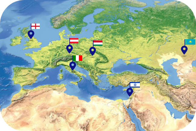
HUNGARY
The project provides GIS for assets management, and inspection on building in the "Ministry of Construction and Housing" and the local authorities.
Back to Top
JERUSALEM MUNICIPALITY
For Image
GIS for education, this project provides a Geographic Information System for educational institutions in the Jerusalem for maintenance and future development according to the city's distinctive requirements.
The project included field surveys using Orhitec's data collection applications on PC pen tablets.
The project results are used by the Education Department at the municipality to plan maintenance tenders each year.
Back to Top
KFAR KARA LOCAL COUNCIL
This project includes photogrammetric mapping all the administered area of the local council, and cadastre maps.
Back to Top
KFAR SHMARYAHU LOCAL COUNCIL
This project provides a complete cadastre registration for the entire built up area in the administrated area of the council.
The project information is being used for town development and lots boundaries for the local residents.
The next stage of the project will be to enable the public to have access to the information from the council web site.
Back to Top
KIRYAT ONO MUNICIPALITY
This project provides establishment of Geographic Information System for data resources management.
Back to Top
KIRYAT MALACHI MUNICIPALITY
For Image
This project consists of:
A survey of municipal taxes.
A survey of building exceptions.
For more information about municipal taxes in GIS you are invited to the products page in our site.
Back to Top
KSIFE LOCAL COUNCIL
For Image
GIS information server for fees and taxes and for engineering.
The project included streamlining of the routine council work processes by using existing data such as digital orthophotos, computerized land planning maps, infrastructure as made maps etc.
The project was initialed in order the update information at the revenue department and to justify the distribution of tax revenue to the public. With Orhitec's methodology, the council is using the collected information for multiple purposes city wide, for example, for city development planning, engineering purposes, and distribution of public domain information.
The property and population data was collected by field survey and updated with PC pen tablet technology, as part of an outsourcing agreement between the company and the council. The pen tablet technology is also being used to identify building and land use violations within the administered area of the Ksife council.
The GIS information server is used to supply building and revenue information to the public, with linkage to the building permits module at the Development and Building Committee of the Negev region.
Back to Top
LOD MUNICIPALITY
For Image
This project consists of collected data from blocs and lots, including orthophotos.
Back to Top
LOWER GALILEE REGIONAL COUNCIL
This GIS project is designed to manage property fees and taxes, and to identify building use violations. Orhitec's GIS information server was installed at the regional council to manage geographic and tax data in the revenue and engineering departments.
Data collected for the project included orthophotos of all the communities in the regional council, property field survey, cadastre, and land use, all linked geographically. The collected data was compared to existing data files at the regional council such as building permits and revenue history to identify building violations.
The GIS information server is being used by the council to supply information to residents and businesses in the area administered by the council.
Using this technology, the council can update data selectively, only where changes have occurred, without the need for resurveying the entire council communities.
More information about GIS in the Lower Galilee project can be found in the 'GIS for Fees and Taxes' under products. page on our web site.
Back to Top
MA'ALE ADUMIM MUNICIPALITY
For Image
This project provides 2 applications:
A survey of watered areas.
Absorption of building insurances, for the need of municipal tax calculation.
More information about municipal taxes in GIS described in our site, under
products.
Back to Top
MASADE LOCAL COUNCIL
This project involved the preparation of digital orthophotos of the administered area of the council to be used as a basis for town planning, water and sewage infrastructure development and maintenance, and for use in a future GIS information server project.
Back to Top
MAZKERET BATIA LOCAL COUNCIL
This project provides a survey of water allocations in GIS.
Back to Top
MEVASERET ZION LOCAL COUNCIL
For Image
This project provides a survey of property taxes in GIS systems.
More information about taxes in GIS is described in our site, under
products.
Back to Top
MIGDAL HA EMEK MUNICIPALITY
This project provides a survey of municipal taxes in GIS systems. More information about municipal taxes in GIS is described in our site under
products.
Back to Top
MODI'IN MUNICIPALITY
For Image
This project provides acceptance of building insurances, for the need of municipal tax calculation and management of foundations.
Back to Top
NAZARETH MUNICIPALITY
For Image
In this project, Orhitec's GIS Information Server provides our GIS interface for municipal taxes and fees, cadastre, engineering departments, and public domain information.
The Engineering Department and the Taxation Department use the GIS to integrate municipal information into one seamless system. Since the system is modular, additional applications that support ESRI or AutoCAD can be added at any time.
Installed modules include the ability to manage public and private property information, including owner name, tenant name, identification numbers, property area, property use, land registry and building permits, digital photographs, and much more.
Linkage and integration of the GIS between the Tax Department and the Engineering Department is designed to save time and expenses, particularly when updating municipal information by using the GIS Information Server as a 'smart' data warehouse. Each department can update its own information so that the system works with full integration of all the information enabling decision makers to have access to all information in real time. An additional benefit of linking the layers among various departments is that building and use violations can be identified within the system without the need for labor intensive field surveys or interfering with the privacy of the residents.
The installed GIS in Nazareth is user-friendly and can be operated by all authorized personnel. Previous hardware or GIS software experience is not necessary.
The data in the GIS Information Server was converted from pre-existing data in the municipality and is routinely managed by municipal employees with the support of Orhitec's help desk.
Back to Top
PARDES HANA MUNICIPALITY
This project provides a survey of municipal taxes in GIS systems.
More information about municipal taxes in GIS is described in our site under
products
.
Back to Top
PETACH TIKVA MUNICIPALITY
For Image
The municipality uses Orhitec's GIS applications for managing traffic sign information, and for field data collection of traffic sign information. The data is collected by special modules for pen tablets that were developed in Orhitec's development depoartment The collected data is being used for formalize and license traffic signs in the city, and to upgrade traffic flow.
The GIS application used in the project is recommended by the Transportation Ministry of the State of Israel.
More details about the Orhitec GIS module for traffic management are described in 'GIS applications' in the
products
page.
Back to Top
RAMAT HOVAV INDUSTRIAL COUNCIL
For Image
This project provides an establishment of entire GIS for the industrial council,
includes tax management and land use.
More information about taxes and land use, can be found under products on our web site.
Back to Top
REINA LOCAL COUNCIL
For Image
This project involved the preparation of digital orthophotos of the administered area of the council to be used as a basis for town planning, water and sewage infrastructure development and maintenance, and for use in a future GIS information server project.
Back to Top
ROSH HA AYIN ECONOMIC COMPANY
For Image
This project provides survey of traffic signs in GIS.
More information about traffic signs in GIS, can be found in the products section of our web site.
Back to Top
ROSH HA AYIN MUNICIPALITY
For Image
This project provides a GIS information server for municipal fees, taxes, engineering, and municipal gardening.
The original purpose of the project was to update the properties and population data base in the municipal billing system and to establish linkage between the revenue department and engineering department at the municipality by using progressive technology with the GIS application. With this new technology, Rosh HaAyin residents will get better and more credible information services and the municipal income will be enhanced and be more fairly balanced. The GIS information server will help also the municipality to shorten the process for approval of building permits. An additional benefit to the municipality is that the GIS enables municipal authorities to quickly and accurately identify building violations.
Date collection is carried out on pen tablet computers using Orhitec's software, Leica's Disto laser distance measuring device, and orthophotos and photogrammetric maps for geographic registration.
The GIS information server is actually a 'smart' geographic data warehouse that can be used and updated by each municipal department for its own information needs.
The municipality plans to create a web site in which the GIS applications will provide public domain information to interested parties. The web site will include digital orthophotos of the city, property survey information, cadastre, and land use information. In addition, Orhitec is preparing a survey of public gardens and green areas in the city.
All GIS information is linked to the billing system of the municipality to enable residents to get information and pay taxes online.
More information regarding GIS applications that are installed in the Rosh HaAyin municipality can be found in the products section of our web site.
Back to Top
SACHNIN MUNICIPALITY
For Image
This project provides a survey of municipal taxes in GIS systems.
More information about municipal taxes in GIS is described in our site under
products
.
Back to Top
SEGEV SHALOM LOCAL COUNCIL
For Image
GIS information server for fees and taxes and for engineering.
The project included streamlining of the routine council work processes by using existing data such as digital orthophotos, computerized land planning maps, infrastructure as made maps etc.
The project was initialed in order the update information at the revenue department and to justify the distribution of tax revenue to the public. With Orhitec's methodology, the council is using the collected information for multiple purposes city wide, for example, for city development plan, engineering purposes, and distribution of public domain information.
The property and population data was collected by field survey and updated with PC pen tablet technology, as part of an outsourcing agreement between the company and the council. The pen tablet technology is also being used to identify building and land use violations within the administered area of the Segev Shalom local council.
The GIS information server is used to supply building and revenue information to the public, with linkage to the building permits module at the Development and Building Committee of the Negev region.
Back to Top
SHOMRON REGIONAL COUNCIL
For Image
A GIS project for property fees and taxes in the Barkan industrial zone.
The project consists of Orhitec's GIS information server to manage data collection including orthophotos of all the communities of the regional council, property field survey, cadastre, and land use. The GIS information server is being used by the council to supply information to residents and businesses in the area administered by the regional council.
Back to Top
TAYIBE MUNICIPALITY
This project provides a survey of water allocations in GIS.
Back to Top
TEL AVIV MUNICIPALITY
For Image
This project provides a survey of advertising devices in GIS system.
Back to Top
YAHUD MUNICIPALITY
This project provides a survey of signs and public gardens.
More information about public gardens can be found in the
products
page on our web site.
Back to Top
YAVNE MUNICIPALITY
For Image
This project provides a survey of municipal taxes and building exceptions.
More information about municipal taxes in GIS can be found in the
products
page on our web site.
Back to Top
ZFAT MUNICIPALITY
For Image
This project provides a survey of municipal taxes in GIS systems.
More information about municipal taxes in GIS is described in our site under
products
.
Back to Top