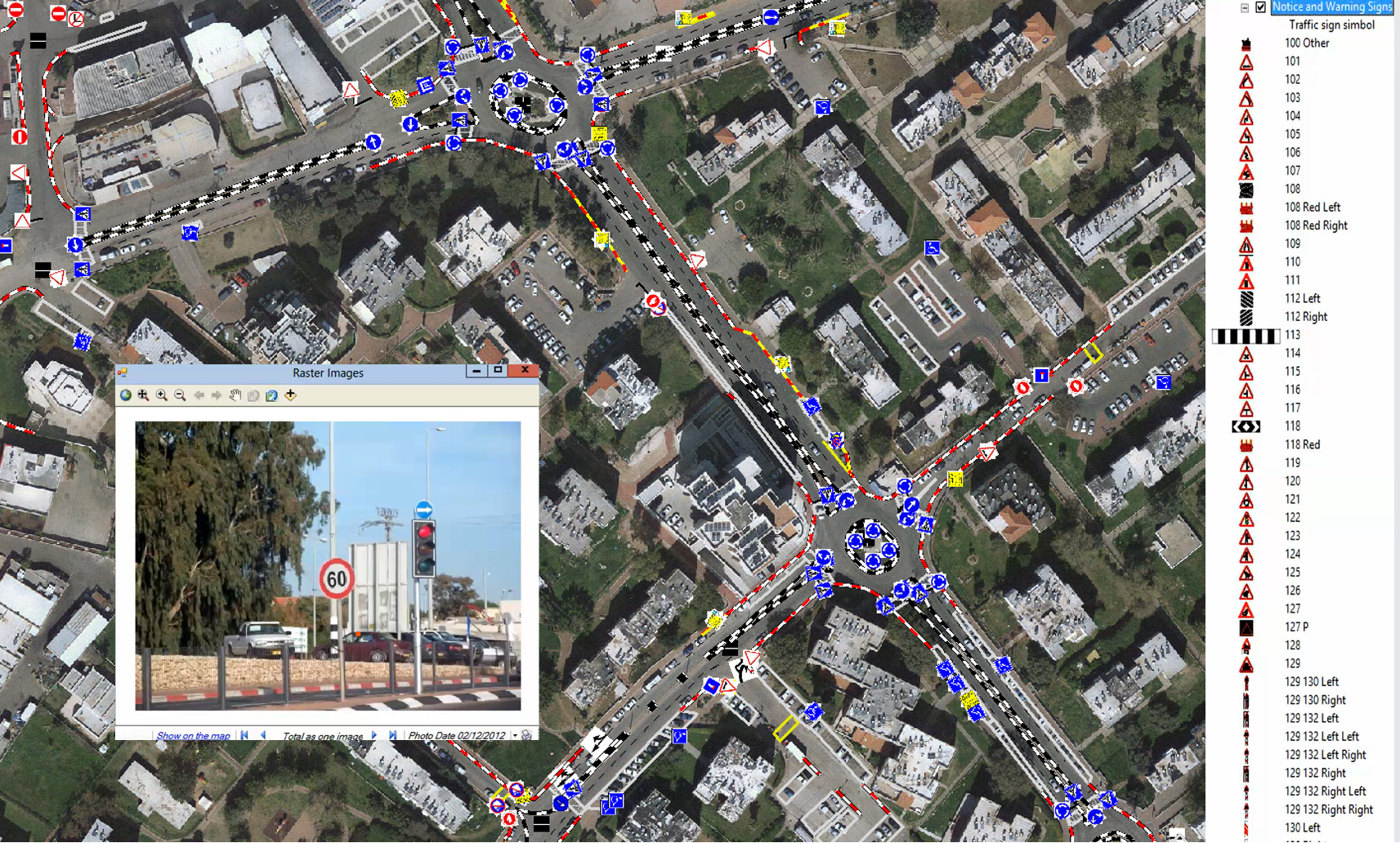
A system for managing a municipal traffic committee to approve Traffic and road signs
Our system has been approved by the Israeli Ministry of Transport and road safety.
The purpose of the system and its capabilities:
- Mapping the array of all road and traffic signs in the authority’s jurisdiction.
- To serve as a database for all types of road signs.
- To get information about road signs using object-oriented questioning, graphic and / or verbal (A-N) that allows to reach requested information by query and / or graphic voting on the map.
- Use of the geographic database as an aid in the areas of Traffic planning, walking routes, Driving roots, Road safety, Emergencies, Parking location, parking fines, Parking permits for the disabled and more.
- Management, support and follow-up in the licensing of road signs, including temporary signs and special permits.
- Management and documentation of protocols for the approval of traffic signs by the Municipal Traffic Committee
- Coordination and integration between different departments in the authority that can use the data for their needs.
- Financial savings in imparting advanced operating methods.
- Streamlining and improving the service to the public.
System Features and characteristics:
- Technology and work environment framework: The system is based on universal platforms: Autodesk & ESRI software, and the databases of Microsoft.
- Production and creation of interactive reports.
- Support for all types of inquiries seeking information.
- Unlimited number of users subject to authorization
- Hosting in the company’s or client cloud.
- Updating versions from time to time
- Data backup and Security.
- Online support for operating the system.
- Friendly user interface.
- Support for decision making procedures
- The application can work as standalone program or as a part of Orhitec’s ERP\GIS Information Server.